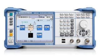
Unverbindliche Preisempfehlung des Herstellers (UVP). Der dargestellte Preis versteht sich ohne USt. Preise und Angebote richten sich nur an Unternehmer und nicht an private Verbraucher.
You may use the electronic signature via DocuSign to submit your information to enroll with the Rohde & Schwarz Customer Delegated Administration program. DocuSign processes the information provided according to their . The minimum system requirements for using the DocuSign system may change over time. The current system requirements are found
Teilnahmebedingungen für das Gewinnspiel „10 Jahre Oszilloskope von Rohde & Schwarz“
1. Das Gewinnspiel „10 Jahre Oszilloskope von Rohde & Schwarz“ (nachfolgend „Gewinnspiel“ genannt) wird organisiert von der Rohde & Schwarz GmbH & Co. KG, Mühldorfstraße 15, 81671 München, Deutschland, Tel. +49 89 41 29 0 (nachfolgend „R&S“ genannt).
2. Teilnehmer können sich zwischen dem 1. Januar 2020 und dem 31. Dezember 2020 mit ihrem Namen, Firmennamen und ihrer geschäftlichen E-Mailadresse registrieren.
3. Die Teilnahme am Gewinnspiel ist kostenlos und nicht vom Erwerb einer Ware oder Dienstleistung abhängig.
4. Teilnahme- und gewinnberechtigt sind nur juristische Personen. Natürlichen Personen ist es nicht gestattet, in ihrem eigenen Namen und auf eigene Rechnung teilzunehmen. Sie dürfen das Teilnahmeformular lediglich in ihrer Eigenschaft als Vertreter einer juristischen Person und im Namen und Auftrag dieser juristischen Person einreichen.
5. Zu gewinnen gibt es innerhalb des Zeitraums vom 1. Januar 2020 bis zum 31. Dezember 2020 jeweils eines von zehn R&S®RTB2000 Oszilloskopen:
Preis: 1x R&S®RTB2000 Digitales Oszilloskop
6. Die Preisverlosung findet am Hauptsitz von Rohde & Schwarz, Mühldorfstraße 15, 81671 München, statt. Die Gewinner werden innerhalb von fünf (5) Werktagen per E-Mail benachrichtigt.
7. Der bevollmächtigte Vertreter der juristischen Person hat die Inanspruchnahme des Gewinns gegenüber R&S zu bestätigen. Bleibt diese Inanspruchnahme aus oder erfolgt keine Antwort innerhalb von zwei (2) Wochen, wird ein neuer Gewinner ermittelt. Wenn innerhalb von vier (4) Wochen kein Gewinner feststeht, endet die Verlosung und der Preis verfällt.
8. Mitarbeiter von R&S und an der Konzeption und Umsetzung des Gewinnspiels beteiligte Personen sowie ihre Familienmitglieder sind nicht berechtigt, das Teilnahmeformular auszufüllen.
9. Eine Barauszahlung oder ein Umtausch von Preisen ist ausgeschlossen. Preise sind nicht übertragbar. Alle Steuern, Abgaben, Zölle, Gebühren und sonstigen Entgelte, die im Land des Teilnehmers erhoben werden, sind vom Teilnehmer zu tragen.
10. Personenbezogenen Daten werden ausschließlich für die Durchführung des Gewinnspiels verwendet und innerhalb von vier (4) Wochen nach Ende des Gewinnspiels gelöscht, sofern nichts anderes vereinbart wurde.
11. Ein Verstoß gegen diese Teilnahmebedingungen berechtigt R&S, den jeweiligen Teilnehmer von der Teilnahme auszuschließen. Handelt es sich bei dem ausgeschlossenen Teilnehmer um einen bereits ausgelosten Gewinner, kann der Gewinn nachträglich aberkannt werden. Wird ein Preis aufgrund eines Verstoßes gegen diese Teilnahmebedingungen nachträglich aberkannt, ist er von dem jeweiligen Teilnehmer auf dessen Kosten an die oben unter Punkt 1 angegebene Anschrift von R&S zurückzusenden, und es wird ein neuer Gewinner ermittelt.
12. Teilnehmer haben keinen Gewinnanspruch. Der Rechtsweg ist ausgeschlossen.
13. Das Gewinnspiel und jedes daraus zwischen R&S und dem jeweiligen Teilnehmer entstehende Vertragsverhältnis unterliegt deutschem Recht und gilt unter Ausschluss kollisionsrechtlicher Regelungen. Für alle Streitigkeiten, die sich mittelbar oder unmittelbar aus der Teilnahme an diesem Gewinnspiel ergeben, wird München als ausschließlicher Gerichtsstand vereinbart.
* “fast delivery” inside 7 working days applies to the Rohde & Schwarz in-house procedures from order processing through to available ex-factory to ship.


